Accessibility maps De Lijn
24079
TML analysed the accessibility of facilities in Flanders with GIS maps that visualise travel times by residence. These insights support De Lijn in optimising its transport network to improve access to essential services and address mobility poverty in a targeted way.
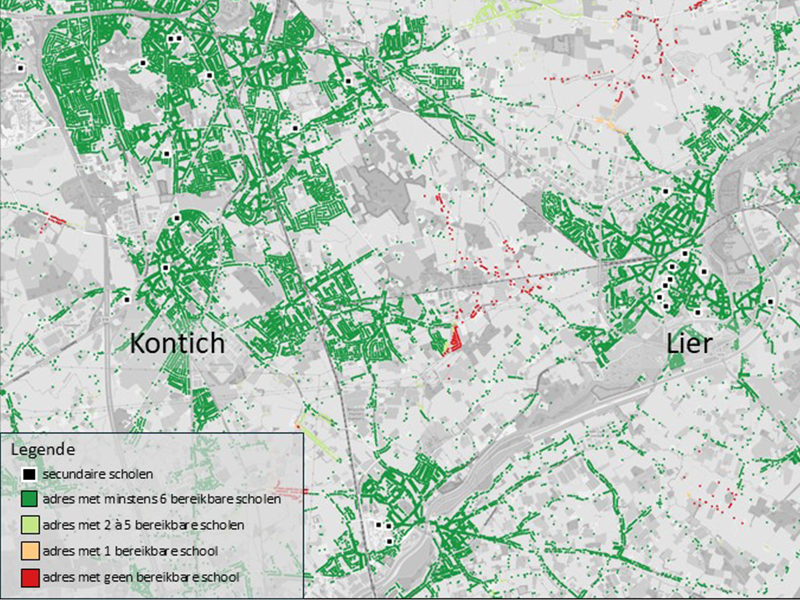
TML took a closer look at the accessibility of essential facilities and workplaces in Flanders on behalf of De Lijn. Using Python, we developed GIS maps that show, for every home in Flanders, how many schools, hospitals, village centres, and workplaces can be reached within 15, 30, or 45 minutes. This analysis was performed for trips by car, bicycle, and public transport (De Lijn and NMBS/SNCB).
These detailed maps not only provide a clear overview of accessibility, but also reveal how well-connected different regions in Flanders are to daily services. By visualising the information per property, we can take a more focused look at the accessibility of certain areas and identify opportunities for improvement.
The project provided De Lijn with enhanced insights to implement targeted improvements to the transport network. This will make it easier for residents to access the services that support their daily lives, while more efficiently matching the use of the transport network to actual needs. In this way, De Lijn can create an offer that better responds to the many isolated areas in Flanders struggling with limited mobility solutions.
